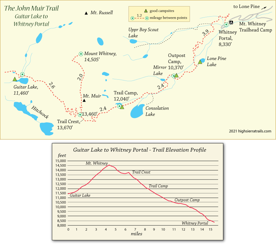
John Muir Trail Map 9
Guitar Lake to Whitney Portal
Most hikers make an early start for the summit of Mt. Whitney, leaving before dawn and making their way up the first switchbacks guided by headlamps. Some leave early enough to enjoy sunrise from the summit. Carry plenty of water since none is likely available until near Trail Camp.
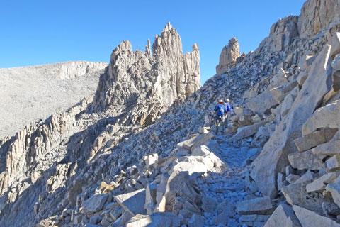
Hikers leave their packs at the trail junction and make the final 2 miles with daypacks. A few sections of the trail to the summit are rugged and require careful attention to footing, but there is little danger for those who move with caution. A stone building is located near the summit along with a register.
The 11-mile descent to Whitney Portal is long and tiresome. Countless switchbacks are followed by weary miles along streams, past lakes, and eventually to the end of the trail. A store and restaurant greet hikers at the portal along with a backpackers' camp.
Ascending Mount Whitney
Along the Way
Wag Bags
Hikers within the Whitney Zone must carry and use wag bags for disposal of human waste. Backpackers are not permitted to dig the familiar cat hole, 6"+, for disposal of human waste. Both poop and toilet paper must be "deposited" in the wag bag and packed out for disposal at the trailhead. The kits are provided by rangers at check-in or at a station along the trail near Crabtree Meadow.
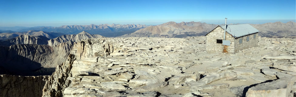
The Smithsonian Mt. Whitney Hut
The stone hut on the summit of Mount Whitney was erected as an observatory by Smithsonian astronomers in 1909. The actual construction of the hut was done by a crew under the direction of Lone Pine resident Gustave Marsh. Donkeys carried the necessary supplies used to build the 11 x 30-foot, 3-room structure. A a sixteen-inch horizontal reflecting telescope and a suitable spectroscope connected with it were installed. In 1977 the hut was placed on the National Register of Historic Places.