John Muir Trail Map

Yosemite Valley to Mt. Whitney

McClure Meadow, Kings Canyon National Park, California

John Muir Trail Map

Yosemite Valley to Mt. Whitney


John Muir Trail Map

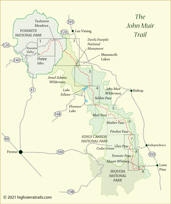
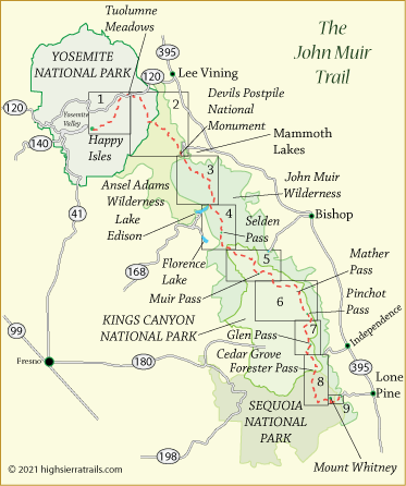
The map displayed below is an overview of the John Muir Trail from Yosemite Valley to Mt. Whitney. To view section maps showing greater detail, click on any of 9 rectangles on the overview map. To view the 9 maps sequentially, click on the Map 1 and then watch for the navigation arrows to move from one map to the next.

Each of the 9 maps includes prominent terrain features, elevations along the trail, lakes and streams, trail descriptions, the best camping spots, and mileages between points. The first 2 maps have portions which are enlarged for even greater detail.

John Muir Trail Map, CA John Muir Trail Map 1 John Muir Trail Map 2 John Muir Trail Map 3 John Muir Trail Map 4 John Muir Trail Map 5 John Muir Trail Map 6 John Muir Trail Map 7 John Muir Trail Map 8 John Muir Trail Map 9
John Muir Trail Map, CA John Muir Trail Map 1 John Muir Trail Map 2 John Muir Trail Map3 John Muir Trail Map 4 John Muir Trail Map 5 John Muir Trail Map 6 John Muir Trail Map 7 John Muir Trail Map 8 John Muir Trail Map 9


    TOP