Vidette Meadow Trail and Map

Kings Canyon National Park

Vidette Meadow with East Vidette and West Vidette peaks, Kings Canyon National Park, California

Vidette Meadow Trail and Map

Kings Canyon National Park


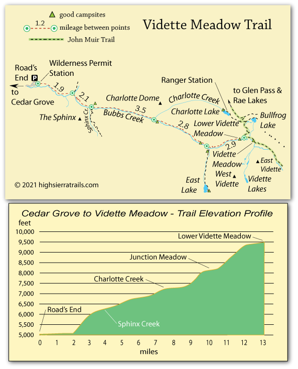
Following the Trail to Vidette Meadow

After the first 2 miles, the trail to Vidette Meadow is a steady uphill hike with 3 good camping areas along the way - Sphinx Creek, Charlotte Creek, and Junction Meadow. Most backpackers make the hike to Lower Vidette Meadow in 2 days, camping at Charlotte Creek.

Shop Amazon for: Hiking Poles


Road's End to Charlotte Creek,

7.5 miles

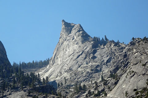
A wide, sandy trail from Road's End soon narrows into shadowy forest and after 2 miles reaches the bridge across the South Fork Kings River leading to the Bubbs Creek trail. After several short bridges over Bubbs Creek, confront a series of 20 switchbacks climbing into the Bubbs Creek Valley. Pass Sphinx Creek and continue to Charlotte Creek. Along the way look back for great views of the Sphinx and as you approach Charlotte Creek watch for views of Charlotte Dome.

Bubbs Creek Bridge, Kings Canyon National Park, California

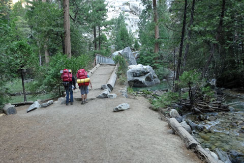
Bridge on Lower Bubbs Creek

Charlotte Creek to Lower Vidette Meadow

5.5 miles

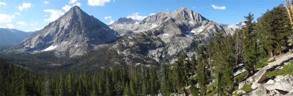
Although the mileage is short, climbing 2,200 feet to Lower Vidette Meadow at an elevation of 9,500 feet takes its toll. Along the trail enjoy small waterfalls, meadows, and wonderful views of North Guard and Mt. Brewer along the Great Western Divide to the south. Water is difficult to access from Junction Meadow to Lower Vidette Meadow.

The Sphinx, Kings Canyon National Park, California

The Sphinx from the Bubbs Creek Trail


Alternate Routes

Kearsarge Pass

Vidette Meadow is also accessible from the east side of the Sierra via 11,700-foot Kearsarge Pass. The trail begins in Onion Valley and leads about 8 miles to Vidette Meadow.

East Lake

At Junction Meadow a side trail crosses Bubbs Creek and climbs 1,300 feet in 2.2 miles to beautiful East Lake. Excellent campsites are availabe at the south end of the lake. Reflection Lake is another 1.7 miles beyond.

Charlotte Lake

From the confluence of Charlotte Creek with Bubbs Creek it is possible to make a strenuous asecent of cross-country travel up Charlotte Creek, eventually connecting with a faint trail from Charlotte Lake into Gardiner Basin. The 4.5-mile hike climbs over 3,000 feet over difficult terrain to Charlotte Lake. Most hikers who use this route come down from Charlotte Lake rather than attempt the uphill direction. Rattlesnakes are common along the way.

Alternate Routes


Kearsarge Pass

Vidette Meadow is also accessible from the east side of the Sierra via 11,700-foot Kearsarge Pass. The trail begins in Onion Valley and leads about 8 miles to Vidette Meadow.

East Lake

At Junction Meadow a side trail crosses Bubbs Creek and climbs 1,300 feet in 2.2 miles to beautiful East Lake. The Bubbs Creek crossing can be hazardous when water levels are high. Check with rangers before setting out. Excellent campsites are available at the south end of the lake. Reflection Lake is another 1.7 miles beyond.

Charlotte Lake

From the confluence of Charlotte Creek with Bubbs Creek it is possible to make a strenuous ascent of cross-country travel up Charlotte Creek, eventually connecting with a faint trail from Charlotte Lake into Gardiner Basin. The 4.5-mile hike climbs over 3,000 feet over difficult terrain to Charlotte Lake. Most hikers who use this route come down from Charlotte Lake rather than attempt the uphill direction. Either direction, it is only suggested for experienced cross-country hikers. Rattlesnakes are common along the way.


Vidette Meadow trail map, Kings Canyon national park, CA

    TOP