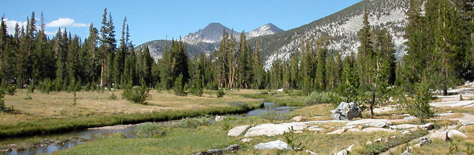
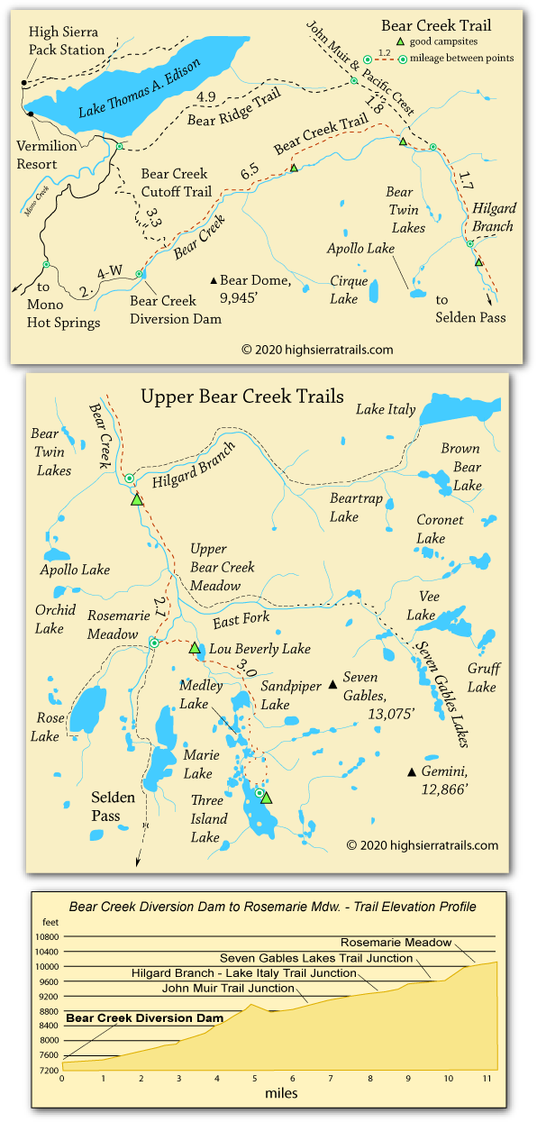
Scenery along the Bear Creek trail changes with every mile. We list the junction with the Hilgard Branch trail as our destination, but many wonderful campsites are available along Bear Creek and at most of the surrounding lakes.
Bear Creek Dam to John Muir Tail
6.5 Miles
The hike up Bear Creek to join the John Muir Trail is an enjoyable 6.5-mile jaunt, climbing about 2,000 feet. Much of the trail is in the forested canyon along Bear Creek, although one exposed section traverses up a broad granite slope. Around mile 5 the trail crosses a summit at 9,000 feet and descends to rejoin Bear Creek a mile before the John Muir Trail junction.
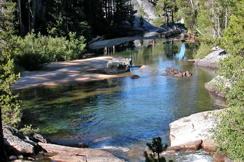
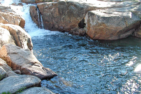
Find good campsites beside Bear Creek at mile 3½ where a waterfall tumbles into a nice pool. Farther up the trail near the junction with the John Muir Trail, several excellent campsites are off to the right by the river.
Bear Creek
John Muir Trail Junction to the Hilgard Branch
1.7 miles
This 1.7-mile section on the John Muir/Pacific Crest Trail follows Bear Creek toward its headwaters. You may encounter more hikers along this part of the trail. Climb at a moderate grade. The Hilgard Branch is marked by a sign pointing up a lateral trail that leads to Lake Italy (5 miles).
Campsites Along the Way
Many campsites are scattered along Bear Creek before and beyond the outlet of the Hilgard Branch, although some sites are not visible from the trail.
Bear Creek
Editors' 2 Cents
We were told by a fisherman we met coming down the trail that he had done especially well fishing at Apollo Lake. We have kept meaning to check it out, but Apollo Lake is well off the trail and 1,000 feet up a steep mountainside. We keep saying that next time we go back to Bear Creek we are going to make the cross-country hike up to Apollo Lake, but it hasn't happened yet.
Maybe just as well. We talked to some other fishermen in 2023 and they told us the fishing at Apollo wasn't very good.
Nearby Orchid Lake affords photographers, and everyone else who makes the arduous climb, wonderful views out across the Bear Creek valley toward 13,000-foot Seven Gables and neighboring peaks.
Getting Acclimated
For many backpackers the drive to the trailhead will take most of a day. It is possible to camp at the trailhead for an early morning start or hike the first several miles to a nice campsite beside Bear Creek. Either way, it allows your body time to adjust some to the altitude before pushing on to higher locations.
Keeping Your Food Safe
Experienced backpackers know that the best way to keep food and scented items (e.g. toothpaste) safe from bears and other animals is to use a bear canister. If you are shopping for a canister, buy the larger one. A small canister is rarely enough for anything but a weekend trip.
Where hanging food from a tree is permitted, we have had excellent success with the carabiner method. Watch a well-done YouTube illustrating this method: Clever Hiker: How to Hang a Bear Bag. This method is both easier and more effective than the often recommended "counter-balance" technique.
Editors' 2 Cents
We were told by a fisherman we met coming down the trail that he had done especially well fishing at Apollo Lake. We have kept meaning to check it out, but Apollo Lake is well off the trail and 1,000 feet up a steep mountainside. We keep saying that next time we go back to Bear Creek we are going to make the cross-country hike up to Apollo Lake, but it hasn't happened yet.
Nearby Orchid Lake affords photographers, and everyone else who makes the arduous climb, wonderful views out across the Bear Creek valley toward 13,000-foot Seven Gables and neighboring peaks.
Getting Acclimated
For many backpackers the drive to the trailhead will take most of a day. It is possible to camp at the trailhead for an early morning start or hike the first several miles to a nice campsite beside Bear Creek. Either way, it allows your body time to adjust some to the altitude before pushing on to higher locations.
Keeping Your Food Safe
Experienced backpackers know that the best way to keep food and scented items (e.g. toothpaste) safe from bears and other animals is to use a bear canister. If you are shopping for a canister, buy the larger one. A small canister is rarely enough for anything but a weekend trip.
Where hanging food from a tree is permitted, we have had excellent success with the carabiner method. Watch a well-done YouTube illustrating this method: Clever Hiker: How to Hang a Bear Bag. This method is both easier and more effective than the often recommended "counter-balance" technique.