Bear Creek Backpacking

John Muir Wilderness

photo of Rosemarie Meadow, John Muir Wilderness, California

Bear Creek Backpacking

John Muir Wilderness


Bear Creek Backpacking

Explore the Wonders of Bear Creek

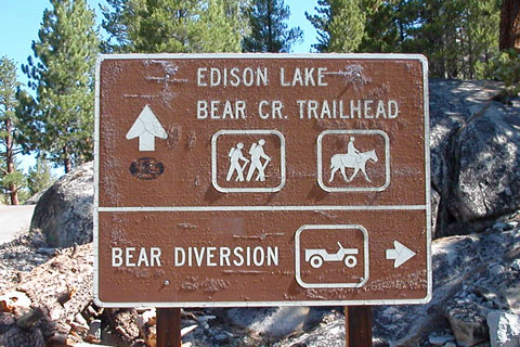
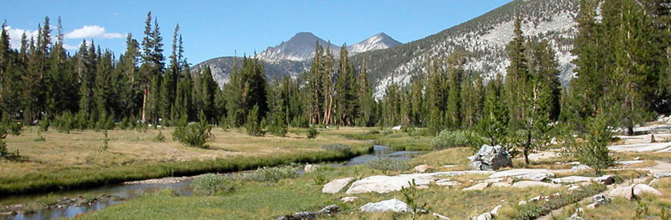
Bear Creek is an avenue to adventure. Set out from the Bear Creek Diversion Dam near Lake Thomas A. Edison. After 6 miles, join the John Muir Trail and follow it south into a playground of alpine lakes and streams.

From a base camp on Bear Creek at the Hilgard Branch junction, explore Lake Italy, Seven Gables Lakes, Sandpiper, Three Island, Marie, and Rose lakes. Venture cross-country to the half-dozen little bear lakes - Black Bear, Bearpaw, Ursa Lake, and others. While all around you soar breathtaking peaks such as Seven Gables, Mt. Senger, and Mt. Hilgard.
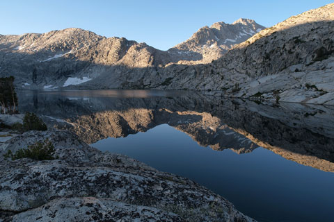
Three Island Lake, John Muir Wilderness, California

Three Island Lake

Bear Creek - Key Facts


Location: John Muir Wilderness, Fresno County, 51 miles east of Prather over Kaiser Pass.
Trailhead: Bear Creek Diversion Dam, elevation 7,350 feet
Elevation of outlet of Hilgard Branch at Bear Creek: 9,317 feet
Elevation Gain to Hilgard Branch: 2,052 feet (including ups and downs)
Hiking Distance: 9 miles to Hilgard Branch junction
Best seasons: Mid-summer to fall
Campsites: Comfortable sites all along most of Bear Creek; campfires permitted below 10,000 feet.

sign to Hilgard Branch, 9 miles

Wildlife

Bears are common along most of the trail, especially once you join the John Muir Trail. Be sure to keep food secured in bear canisters or properly hung with the counter-balance method over a high tree limb. Rattlesnakes are uncommon along this trail, but travelers should always use caution. Mosquitoes are pesky in the early summer. Plan your trip for late August to avoid the worst of them or September when cold nights keep the mosquitoes away.

Among the birds you may spot along the way are the Mountain Quail, Hammonds's Flycatcher, wrens, chicadees, Western Scrub-Jays, finches, and sparrows.


Bear Creek sign, John Muir Wilderness, California

Turn for Bear Creek Diversion Dam


Trekking Poles


Women and Men's Hats


Bear Creek - Key Facts


Location: John Muir Wilderness, Fresno County, 51 miles east of Prather over Kaiser Pass.
Trailhead: Bear Creek Diversion Dam, elevation 7,350 feet
Elevation of outlet of Hilgard Branch at Bear Creek: 9,317 feet
Elevation Gain to Hilgard Branch: 2,052 feet (including ups and downs)
Hiking Distance: 9 miles to Hilgard Branch junction
Best seasons: Mid-summer to fall
Campsites: Comfortable sites all along Bear Creek; campfires permitted below 10,000 feet.

sign to Hilgard Branch, 9 miles

Bear Creek Diversion Dam Trailhead

The Bear Creek Diversion Dam trailhead for the Bear Creek Trail is 51 miles east of Prather on Highway 168. (Fill up on gas in Prather or Shaver Lake.) The last 18 miles are over narrow and steep Kaiser Pass Road. Plan extra time for this part of the trip. The final 2.3 miles to the trailhead require a 4-wheel drive vehicle with good clearance. Options include hiking the 4-wheel road or departing from an alternate trail near Lake Edison.

Parking

Parking: Park on glaciated granite at the trailhead. There are no facilities.

Alternate Trails

An alternate trail begins near the dam at Lake Thomas A. Edison. This 5-mile trail traverses the hillside south of the lake, eventually crossing over the ridge at 9,500 feet and descending to meet the John Muir Trail. Another trail crosses the ridge to the Bear Creek Trail from a trailhead south of the dam. Both are longer and less-appealing routes.


Nearby Camping and Lodging


Good campgrounds are found near Lake Edison and out toward Florence Lake. Lodging is available at Vermilion Valley Resort at Lake Edison and also at nearby Mono Hot Springs. Both resorts have small stores.